
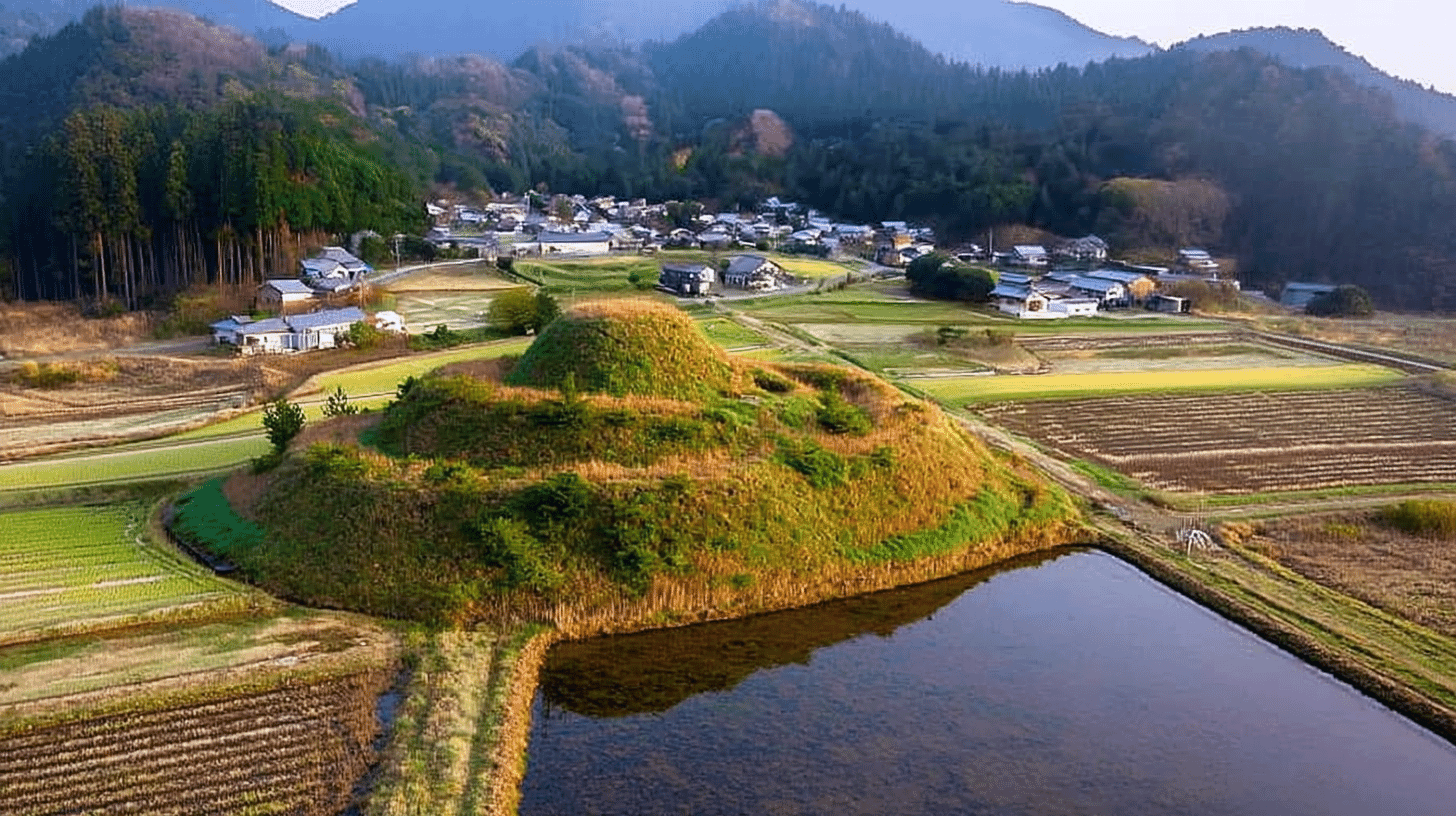
One Tumulus, Designated by the State in 1935
Jonozuka Tomb (上ノ塚古墳, Jonozuka Kofun) lies in Wakasa Town, Mikatakaminaka District, Fukui Prefecture, a keyhole-shaped tumulus designated by the state on 24 December 1935. Its category is that of historic sites.
The managing body is Wakasa Town.
The Agency records a keyhole-shaped tumulus whose mound is raised in three tiers and faces north. A keyhole tomb joins a round part to a squared one; the mound is the earth heaped over the grave.
Fields on the Mound, Paddies in the Moat
The tomb has been worked as farmland.
The Agency records that the top of the mound became dry fields, and that the traces of the moat around it survive almost entirely as rice paddies.
Crops grow on the heaped earth, and the moat's course remains as paddy. The form of the grave has come down to us while being tilled.
The record then closes that it is the most finely formed tumulus in this district.
Farmland on it, and the judgement that it is the finest in its district, stand together in the same passage.
At the Kanenokuma site, the excavation is shown under a roof. Here the tomb is recorded as it stands, in use as cultivated ground.
Measured in Ken and Shaku
Its size survives in units no longer in daily use.
The Agency gives a length of about 45 ken, a diameter of about 28 ken for the round part, and a height of about 18 shaku.
One ken is about 1.8 metres and one shaku about 0.3 metres. So the length is about 82 metres, the diameter about 51 metres, and the height about 5.5 metres.
The Shimotoriwata memorial stone is given as 5 shaku 9 sun 5 bu high. At Nakabusa hot spring, too, the commentary survives in the katakana literary style of its day.
This commentary likewise keeps the style and the units of its designation in 1935. The ken is used because a mound of this size calls for it.
The mound is raised in three tiers and faces north.
About Forty Ken South-East of Another Tomb
Its place is given as a distance from another tumulus.
The Agency records it as lying about 40 ken south-east of the Nishizuka tomb: about 73 metres.
Not by place-name or lot number, but by direction and distance from a nearby tomb, its position is given.
At the Tani Yutaka residence, the annex and the privy are placed from a main house that is not itself registered.
Here the reference is another tomb. The Agency records that, with Nishizuka and others, it is held to be the grave of the ancestor of the provincial chiefs of Wakasa.
Such chiefs governed a district in antiquity. The words held to be present this as what is said.
Visiting
The tomb lies in Wakasa Town, Mikatakaminaka District, Fukui Prefecture, with the town as managing body.
The record reads the name Jonozuka, and the English name follows that reading.
The mound and its surroundings have been worked as farmland. Whether one may enter follows the arrangements of the managing body and those who use the land. Check before travelling.
The managing body was appointed two years after the designation.
No owner is recorded.
Q&A
- When was the tomb designated?
- On 24 December 1935, by the state, as a historic site.
- How large is it?
- About 45 ken long (some 82 metres), the round part about 28 ken across (some 51 metres), and about 18 shaku high (some 5.5 metres).
- How has it been used?
- The record says the top of the mound became dry fields and the moat traces survive almost entirely as rice paddies.
- Whose grave is it held to be?
- With Nishizuka and others, it is held to be the grave of the ancestor of the provincial chiefs of Wakasa, as tradition has it.
- What is valued in it?
- That it is the most finely formed tumulus in this district.
Basic Information
| Name | Jonozuka Tomb (上ノ塚古墳, Jonozuka Kofun) |
|---|---|
| Location | Wakasa Town, Mikatakaminaka District, Fukui Prefecture |
| Designation | Historic site; designated as an archaeological site rather than as a building or a work of art |
| Year Designated | 1935 (24 December), designated |
| Quantity | 1 keyhole-shaped tumulus |
| Dimensions | About 45 ken long (some 82 metres), the round part about 28 ken across (some 51 metres), about 18 shaku high (some 5.5 metres). The mound is raised in three tiers and faces north |
| Owner | Not stated in the record (Wakasa Town is the managing body) |
| Public Access | The mound and its surroundings have been farmed; entry follows the arrangements of the managing body and the land's users |
References
- Cultural Heritage Online: the tomb
- https://bunka.nii.ac.jp/heritages/detail/138447
- Wakasa Town: history and culture section
- https://www.town.fukui-wakasa.lg.jp/soshiki/rekishibunkaka/gyomuannai/3/1/2/918.html
- Agency for Cultural Affairs, National Cultural Properties Database
- https://kunishitei.bunka.go.jp/
- Wakasa Town
- https://www.town.fukui-wakasa.lg.jp/
Last verified: 2026.09.24