Jōkōmyō-ji Temple Site Map: A Window into Medieval Kamakura
Hidden within the archives of the Kamakura Museum of National Treasures lies a document of extraordinary historical significance: the Jōkōmyō-ji Temple Site Map (浄光明寺敷地絵図). Designated as an Important Cultural Property of Japan, this remarkable ink painting on paper is nothing less than the only surviving pictorial map that depicts Kamakura during the Kamakura period itself. Created in the tumultuous years immediately following the fall of the Kamakura Shogunate in 1333, this map offers an unparalleled glimpse into the medieval city that once served as Japan's political center.
What is the Jōkōmyō-ji Temple Site Map?
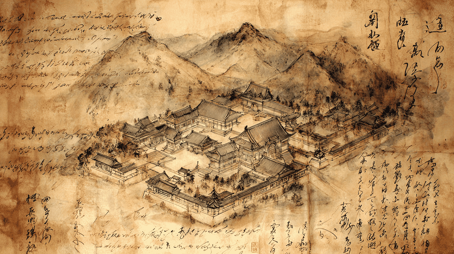
The Jōkōmyō-ji Temple Site Map is a pictorial estate map (絵図, ezu) painted on four sheets of mulberry paper (楮紙) joined together. At its center, the characters "浄光明寺敷地□圖" (Jōkōmyō-ji Shikichi Ezu) are written in ink, identifying this as a map of the temple's grounds. The document measures approximately 63 centimeters in height and depicts not only the temple's buildings and boundaries but also the surrounding landscape, nearby residences, and abandoned temple sites.
Directional markers appear in three corners of the map: "North" (北) in the upper right, "East" (東) in the lower right, and "South" (南) in the lower left. The upper left corner, which would have indicated "West," has been damaged over the centuries. At the center of the composition, the temple's main hall (仏殿) is depicted in remarkable detail, shown as a five-bay structure with a skirt-roof (裳層) sitting atop a raised platform.
Why Was It Designated an Important Cultural Property?
The Jōkōmyō-ji Temple Site Map received its designation as an Important Cultural Property on June 9, 2005, recognizing its exceptional value as a historical document. Several factors contribute to its significance:
First and foremost, it is the only surviving pictorial map that depicts Kamakura during the medieval period. While numerous historical documents describe the city, no other visual record from the era has survived to the present day. This makes the map an irreplaceable resource for understanding the urban layout, architecture, and social organization of medieval Kamakura.
Second, the map provides concrete evidence of the dramatic political transition that followed the fall of the Kamakura Shogunate. The document shows former residences of the Hōjō clan—the warrior family that had dominated the shogunate—now marked as abandoned "ruins" (跡). These include the residence of Akahashi Moritoki (赤橋守時, 1295-1333), the last regent of the Kamakura Shogunate, who died defending Kamakura in its final days.
Third, the map bears the signatures (花押, kaō) of Uesugi Shigenō (上杉重能, died 1349), a powerful retainer of the Ashikaga clan who would help establish the Muromachi Shogunate. These seven signatures, placed around the map's borders with their heads pointing toward the temple grounds, served as official endorsements of the temple's land claims under the new Kenmu government.
Historical Context: A Document Born from Political Upheaval
To fully appreciate the Jōkōmyō-ji Temple Site Map, one must understand the dramatic historical context in which it was created.
In May 1333, the Kamakura Shogunate—which had ruled Japan for nearly 150 years—fell to the forces of Emperor Go-Daigo and his allies. The capital city of Kamakura was attacked and burned. The Hōjō clan, which had controlled the shogunate as regents, was nearly annihilated. The lands and residences of the defeated clan became ownerless, creating an opportunity for institutions like Jōkōmyō-ji Temple to expand their holdings.
The temple, founded around 1251 by the fifth and sixth Hōjō regents, had long been associated with the warrior elite of Kamakura. Following the shogunate's collapse, the temple sought to secure its landholdings under the new Kenmu government established by Emperor Go-Daigo. The site map was created as part of this petition, documenting the temple's existing grounds and identifying former Hōjō properties that the temple wished to incorporate.
Red ink annotations reading "今所望" (ima shomō, "now desired") mark properties that the temple hoped to acquire. The presence of Uesugi Shigenō's signatures indicates that at least some of these requests were approved. Since Uesugi left Kamakura in December 1335, historians can date the map's creation to the brief period between the shogunate's fall in 1333 and late 1335—a span of just over two years.
What the Map Reveals About Medieval Kamakura
The Jōkōmyō-ji Temple Site Map offers invaluable insights into the physical and social landscape of medieval Kamakura. Beyond the temple's own buildings, the map depicts several surrounding sites:
- Tahō-ji Temple (多寳寺) – An abandoned temple site to the east of Jōkōmyō-ji. Along with Gokuraku-ji and Jōkōmyō-ji, Tahō-ji was one of the major Shingon Ritsu sect temples in medieval Kamakura. Today, only cave tombs (yagura) remain on the site behind Jōkōmyō-ji's grounds.
- Tōrin-ji Temple (東林寺) – Another abandoned temple shown on the map, indicating the religious landscape of the area.
- Moritoki-ato (守時跡) – The former residence of Akahashi Moritoki, the last regent of the Kamakura Shogunate, who committed suicide during the city's fall.
- Umagonnosuke-ato (右馬権助跡) and Gyōbu-ato (刑部跡) – Other abandoned residences of Hōjō-affiliated warriors.
A letter in the Kanazawa Bunko archives, written by Kanazawa Sadaaki (金沢貞顕, 1278-1333), describes a fire that occurred near Jōkōmyō-ji Temple and mentions "Umagonnosuke" and "Gyōbu" by name. This correspondence corroborates the map's depictions and confirms that these locations remained consistent over time.
The Map's Mysterious Disappearance and Rediscovery
One of the most intriguing aspects of the Jōkōmyō-ji Temple Site Map is its dramatic history of loss and rediscovery. The map was known to scholars from historical records dating back to 1685, when it was described in the Shinpen Kamakura-shi (新編鎌倉志). However, at some point in subsequent centuries, the document went missing from the temple's collection.
For generations, the map's whereabouts remained unknown. Then, in 2000, an astonishing discovery was made: the map was found in the possession of an old family in Kamakura. In 2001, it was returned to Jōkōmyō-ji Temple, and four years later, in 2005, it received designation as an Important Cultural Property of Japan.
Today, the map is deposited at the Kamakura Museum of National Treasures (鎌倉国宝館), where it is preserved under carefully controlled conditions to protect this fragile 700-year-old document for future generations.
Visiting Jōkōmyō-ji Temple
While the site map itself is held at the Kamakura Museum of National Treasures and is not always on public display, a visit to Jōkōmyō-ji Temple offers the chance to walk the very grounds depicted in this remarkable document. The temple preserves much of its medieval character, with terraced grounds carved into the hillside that reflect the layout shown in the 14th-century map.
The temple houses several other Important Cultural Properties, including a magnificent wooden Amida Triad (阿弥陀三尊像) decorated with "domon" (土紋)—a unique clay appliqué technique found only in medieval Kamakura Buddhist sculpture. Visitors can also explore the hillside behind the temple, where cave tombs (yagura) and the grave of the poet Reizei Tamesuke (冷泉為相, 1263-1328) can be found.
The temple grounds and the grave of Reizei Tamesuke together form a National Historic Site, recognized in part due to insights gained from the rediscovered site map. The map demonstrated that the medieval temple grounds have been remarkably well preserved over seven centuries.
Nearby Attractions
Jōkōmyō-ji Temple is located in the Ogigayatsu (扇ガ谷) neighborhood of Kamakura, an area rich in historical sites. Nearby attractions include:
- Kamakura Museum of National Treasures (鎌倉国宝館) – Located within the Tsurugaoka Hachimangū shrine grounds, this museum houses the site map and numerous other treasures from Kamakura's temples and shrines. Check exhibition schedules before visiting.
- Kamakura Museum of History and Culture (鎌倉歴史文化交流館) – A modern museum about 7 minutes' walk from Jōkōmyō-ji, offering excellent exhibits on Kamakura's history.
- Eishō-ji Temple (英勝寺) – The only nunnery in Kamakura, featuring beautiful Edo-period architecture and seasonal flowers.
- Kaizō-ji Temple (海蔵寺) – Known for its beautiful garden and seasonal flowers, about 8 minutes' walk away.
- Genjiyama Park (源氏山公園) – A park offering views of Kamakura and home to a statue of Minamoto no Yoritomo, founder of the Kamakura Shogunate.
- 📍 Plan Your Visit to Kanagawa
- Find tours, activities & transport passes near Jokomyoji Temple Site Map
- [ Kamakura Buddha Hakone Onsen & Yokohama Tours ]
Q&A
- Can I see the actual Jōkōmyō-ji Temple Site Map?
- The map is deposited at the Kamakura Museum of National Treasures (鎌倉国宝館) within the grounds of Tsurugaoka Hachimangū shrine. As a fragile historical document, it is not always on display. Check the museum's exhibition schedule before visiting to see if it is currently being shown.
- What makes this map unique among Japanese historical documents?
- The Jōkōmyō-ji Temple Site Map is the only surviving pictorial map that depicts Kamakura during the Kamakura period (1185-1333). While many written documents describe medieval Kamakura, no other visual record from that era has survived. This makes it invaluable for understanding the city's layout, architecture, and social structure.
- When is the best time to visit Jōkōmyō-ji Temple?
- The temple's main treasures, including the Important Cultural Property Amida Triad, can only be viewed on Thursdays, Saturdays, Sundays, and holidays (weather permitting). The temple is closed to inner sanctuary visits during August and rainy days. Spring (plum and cherry blossoms) and autumn (red spider lilies and foliage) offer particularly beautiful scenery.
- Is English guidance available at the temple?
- Limited English information may be available at the temple. For a deeper understanding, consider bringing a guidebook or researching beforehand. The Kamakura Museum of National Treasures offers some English-language materials and audio guides.
- How does the temple site today compare to the medieval map?
- Remarkably well! The rediscovery of the map in 2000 confirmed that the temple's terraced layout, carved into the hillside in a characteristic "yato" valley pattern, has been preserved for nearly 700 years. This preservation was a key factor in the expanded designation of the temple grounds as a National Historic Site in 2007.
Basic Information
| Name | Jōkōmyō-ji Temple Site Map (浄光明寺敷地絵図) |
|---|---|
| Designation | Important Cultural Property of Japan (国指定重要文化財) |
| Date Designated | June 9, 2005 |
| Period Created | Nanboku-chō Period (1333-1335) |
| Material | Ink on paper (four sheets of mulberry paper joined together) |
| Owner | Jōkōmyō-ji Temple (浄光明寺) |
| Current Location | Deposited at Kamakura Museum of National Treasures (鎌倉国宝館) |
| Temple Address | 2-12-1 Ogigayatsu, Kamakura, Kanagawa 248-0011, Japan |
| Access | 15-minute walk from JR/Enoden Kamakura Station (West Exit) |
| Temple Hours | Grounds: 9:00-16:00 daily; Inner Sanctuary: 10:00-12:00 & 13:00-16:00 (Thu, Sat, Sun, Holidays only; closed during rain and August) |
| Temple Admission | Grounds: Donation; Inner Sanctuary: ¥300 (adults), ¥150 (children) |
| Museum Hours | 9:00-16:30 (last entry 16:00); Closed Mondays |
| Museum Admission | Varies by exhibition (typically ¥400-700) |
References
- Cultural Heritage Online - Jōkōmyō-ji Temple Site Map
- https://bunka.nii.ac.jp/db/heritages/detail/213919
- Wikipedia - Jōkōmyō-ji Temple
- https://ja.wikipedia.org/wiki/浄光明寺
- Cultural Heritage Online - Jōkōmyō-ji Temple Grounds and Reizei Tamesuke Grave
- https://bunka.nii.ac.jp/heritages/detail/190492
- Yoritomo Japan - Jōkōmyō-ji Site Map
- https://www.yoritomo-japan.com/kamakura137/jyokomyoji-ezu.html
- Makoto-do Blog - Jōkōmyō-ji Site Map Reproduction
- http://makotodo.sblo.jp/article/189970659.html
- Kamakura Museum of National Treasures Official Website
- https://www.city.kamakura.kanagawa.jp/kokuhoukan/
Last verified: 2026.01.28