
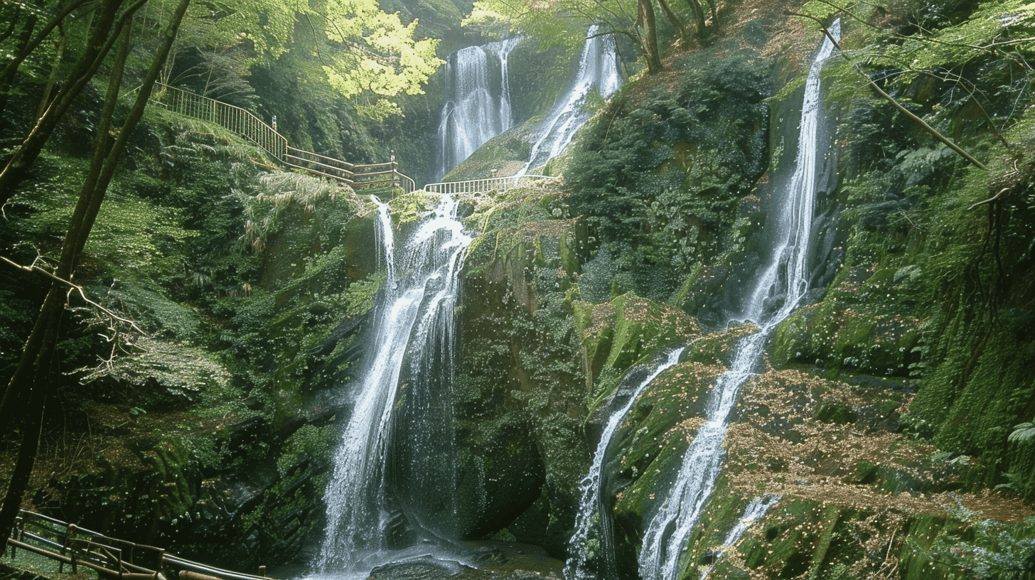
Seven Steps Over a Conglomerate Fault, Designated in 1934
Atera Seven Waterfalls (阿寺の七滝, Atera no Nanataki) is a waterfall on the Atera River in Shinshiro City, Aichi Prefecture, designated a national Place of Scenic Beauty and Natural Monument in 1934, on 22 January. Shinshiro City is the managing body. The designated area covers about 9.1 hectares including the falls.
Water running down from the Suyama plateau falls in seven steps over a conglomerate fault scarp, and that is where the name comes from. There are not seven separate falls; a single stream drops in seven stages.
The grounds for designation are scientific. Shinshiro City records that the falls were designated as important for study because they run over conglomerate and because of the great potholes there. Beauty of landscape and geological value are both recognised, which is why two classes of designation apply.
The Seven Steps
The drops are far from equal. Shinshiro City gives them, from the bottom, as 9 metres, 13 metres, 7 metres, 25 metres, 2 metres, 4 metres and 2 metres, 62 metres in all.
The fourth step, at 25 metres, dwarfs the rest. The fifth and the topmost are both 2 metres, more than twelve times smaller. The word seven suggests an even stair; the reality is not.
Each step has its own name. From the bottom: Hekireki, Kosho, Ryujo, Chogei, Yuhi, Soren and Koko.
Shinshiro City also notes a point for visitors: looking up from below, only the first four steps are visible. All seven cannot be seen at once, and it is worth knowing that the view from the bottom reaches the fourth step.
The Potholes That Justify the Designation
The plunge pools hold deep potholes. The pool of the second fall is 4 metres deep and that of the fifth 7 metres.
Shinshiro City explains that stones fallen into the pools have been rolled by the force of the water over many years, grinding the rock away to form potholes. The force of the falling water bores a hole in the rock over a long span of time.
Conglomerate is rock formed from rounded pebbles bound together. The pebbles here are mostly around 20 centimetres, made up of sandstone, mudstone, granite and other rocks of the Mesozoic and Palaeozoic eras.
A waterfall running over conglomerate is an unusual condition, and that is why it is held important for study. Conglomerate does not erode evenly because its hardness varies, and the stepped form of the falls follows from that rock and the fault together.
Traditions
The conglomerate below the falls is called the child-holding stone, and worship at it is said to bring children. The dragon deity of the falls has been venerated as a god of rainmaking.
There is also a legend that the diviner Abe no Seimei trained here in his youth, and a well said to have been used by him still stands.
These are traditions, not the grounds for designation. The national designation rests on the geological conditions of conglomerate and potholes. Tradition and designation should not be run together.
The Median Tectonic Line runs nearby. The relation between fault and waterfall is a matter of geology; claims of spiritual effect drawn from it are outside what this article covers.
Visiting
There is no charge to see Atera Seven Waterfalls and no fixed hours. From the car park it is about 15 minutes on foot.
The path follows the stream and the footing can be wet. Wear shoes you can walk in. Access may be closed when the water is high.
The designated area is large, about 9.1 hectares, taking in the surrounding natural woodland as well as the falls. Collecting or removing anything is restricted, so do not disturb the stones or the plants.
From the Shinshiro interchange on the Shin-Tomei Expressway it is about 25 minutes by car. From Hon-Nagashino Station on the JR Iida Line a car is also needed.
Q&A
- When were Atera Seven Waterfalls designated?
- On 22 January 1934, as a national Place of Scenic Beauty and Natural Monument. Shinshiro City is the managing body, and the designated area covers about 9.1 hectares including the falls.
- Why were they designated?
- Shinshiro City records that they were designated as important for study because they run over conglomerate and because of the great potholes there. Beauty of landscape and geological value are both recognised, which is why two classes of designation apply.
- How large is each of the seven steps?
- From the bottom: 9 metres, 13 metres, 7 metres, 25 metres, 2 metres, 4 metres and 2 metres, 62 metres in all. The fourth dwarfs the rest, so the word seven suggests an even stair that the reality does not match.
- What is a pothole here?
- A hole ground into the rock by stones that have fallen into a plunge pool and been rolled by the force of the water over many years. The pool of the second fall is 4 metres deep and that of the fifth 7 metres.
- Can the falls be visited?
- Yes, at no charge and with no fixed hours, about 15 minutes on foot from the car park. The path follows the stream and can be wet, and access may be closed when the water is high. Looking up from below, only the first four steps are visible.
Basic Information
| Name | Atera Seven Waterfalls (阿寺の七滝, Atera no Nanataki) |
|---|---|
| Location | Shimoyoshida, Shinshiro City, Aichi Prefecture |
| Designation | Place of Scenic Beauty and Natural Monument; one of Japan's hundred selected waterfalls |
| Year Designated | 1934 (22 January), Place of Scenic Beauty and Natural Monument |
| Quantity | Designated area of about 9.1 hectares including the falls |
| Dimensions | Total drop 62 metres. From the bottom: 9 metres, 13 metres, 7 metres, 25 metres, 2 metres, 4 metres, 2 metres. Plunge pools reach 4 metres and 7 metres deep |
| Owner | Managed by Shinshiro City |
| Public Access | No charge and no fixed hours; about 15 minutes on foot from the car park. Only 4 steps are visible from below |
References
- Shinshiro City: Atera no Nanataki
- https://www.city.shinshiro.lg.jp/kanko/meisyo/ateranonanataki.html
- Cultural Heritage Online: Atera no Nanataki
- https://online.bunka.go.jp/heritages/detail/216629
- Aichi Now: Atera no Nanataki
- https://aichinow.pref.aichi.jp/spots/detail/138/
- Aichi Prefecture, cultural properties navigator
- https://www.pref.aichi.jp/kyoiku/bunka/bunkazainavi/
Last verified: 2026.09.03