
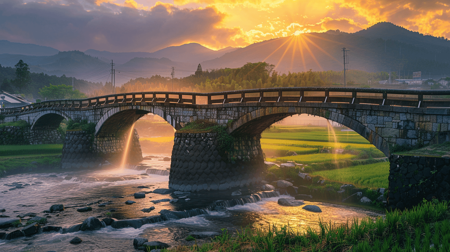
A Stone Aqueduct of 1854, the First Civil Engineering National Treasure
Tsujun Bridge (通潤橋, Tsujunkyo) is a stone arch aqueduct of 1854 at Jobaru and Nagahara, Yamato Town, Kamimashiki District, Kumamoto Prefecture, designated an Important Cultural Property on 9 February 1960 and a National Treasure on 25 September 2023. It is the first civil engineering structure in Japan to hold National Treasure status. It belongs to the town of Yamato and the Tsujun district land improvement association.
The Agency for Cultural Affairs begins with what the bridge is for. Part of the Tsujun irrigation system spreading over the hills south of the outer rim of Aso, it was built to water the Shiraito plateau, cut off by ravines on every side and short of water, by carrying one of the largest stone arches of the early modern period across a gorge. It unites that arch with high stone walls of great precision, made earthquake-resistant by sheath walls and packed backing, and a siphon of durable stone pipes, into a masterpiece of the early modern stone bridge of the very highest technical accomplishment.
Kumamoto Prefecture records that work began in December 1852 and was completed at the end of August 1854. The bridge is about 78.0 metres long, 21.3 metres high and 6.6 metres wide. The span between the exposed arch stones is about 26.5 metres, but because the base of the arch is hidden by the sheath walls the true span is unknown; historical documents give 15 ken 3 shaku, about 28.1 metres.
An Inverted Siphon: Lifting Water Above the Bridge
What sets Tsujun Bridge apart is that the bridge itself sits lower than the Shiraito plateau. Water flowing over it would never reach the fields. To lift it, the builders used the principle of the inverted siphon.
The intake on the north side stands about two metres higher than the outlet on the south. Water passing through a sealed pipe will be forced up again by pressure, provided the outlet lies below the intake, even if the pipe dips to the level of the bridge on the way. Three rows of pipes cut from tuff run across the top of the bridge, their joints sealed with lime plaster to withstand the pressure. They were known at the time as the fukiage-hi, the blowing-up conduit, and they are what the Agency means by a siphon of durable stone pipes.
This structure is also why Tsujun is the only stone arch bridge in Japan that can discharge water. To flush sand and silt from the pipes, plugs at the centre of the bridge are pulled and the water thrown out. The discharge is maintenance of the irrigation system, not a display.
Sheath Walls and Packed Backing: The Walls That Hold the Arch
The Agency's citation puts the stone walls, not only the arch, at the centre of its judgement, in the phrase high stone walls of great precision, made earthquake-resistant by sheath walls and packed backing.
A sheath wall is a second wall laid over the outside of the abutment like a scabbard, enclosing the foot of the arch and taking lateral force. Packed backing fills the space behind a wall with stone to give it depth, so that it resists collapse when shaken. The weakness of an arch lies at its two ends, where the abutments are pushed outward, and at Tsujun those abutments are locked in high walls.
In the Kumamoto earthquake of 2016 part of the walling bulged and the discharge was stopped. After repair, discharges resumed in 2020. That sequence shows how a stone arch in an earthquake country has been carried through 170 years by the technique of its walls.
District Officials and Stonemasons: Who Decided What
Where the Agency's citation presses hardest is not on the technique itself but on who made it and how. This unparalleled technique, it says, was created in the late and final Edo period, when local communities took the lead in building public infrastructure, by the district officials of the Kumamoto domain, who showed outstanding capacity to carry a project from planning to completion, and by a body of stonemasons of the highest skill of their day, through repeated experiment and consultation with the domain.
The district officials were the headmen of the tenaga, the local administrative units of the Kumamoto domain; at Tsujun the headman of the Yabe tenaga, Futa Yasunosuke, filled that role. The stonemasons were the Taneyama masons of Yatsushiro, led by the master Uichi and his deputy Johachi, later Hashimoto Kangoro. Futa studied the structure of the nearby Okegataki and Reidai bridges and repeated experiments on the principle of connected vessels before putting his plan to the domain.
The Agency concludes that the bridge shows one of the mature forms of early modern hydraulic engineering and stands as a civil engineering structure symbolic of the stone bridge culture that flourished in Kyushu at the end of the Edo period. It is designated as the product of a community, rather than a domain, building its own infrastructure.
Visiting
The bridge can be viewed freely from the surrounding grounds, with the Tsujunkyo roadside station as a base, and there is no charge to see the exterior. There are periods when the top of the bridge can be walked and periods when access is restricted for safety, so check the town's notices before travelling.
The discharge does not happen every day. It takes place around 120 times a year on dates published in a discharge calendar, and is suspended in the busy farming season and in drought. In 2026 discharges resumed from 13 August. Anyone coming for the discharge must confirm the date in advance. Seen from downstream, the height of the falling water is clearest.
The roadside station houses the Tsujun Bridge museum, where the inverted siphon and the building of the bridge are explained with models. Stopping there first makes clear what the stone pipes overhead are doing.
By car it is about 10 minutes from the Yamato-Tsujunkyo interchange on the Kyushu Chuo Expressway, or about an hour and 20 minutes from central Kumamoto. By public transport, the bus from the Kumamoto bus centre toward Tsujun-sanso takes about an hour and a half to the Tsujunkyo-mae stop.
Q&A
- When was Tsujun Bridge built and designated?
- Work began in December 1852 and finished in August 1854. The bridge became an Important Cultural Property on 9 February 1960 and a National Treasure on 25 September 2023, the first civil engineering structure in Japan to be so designated.
- Why was Tsujun Bridge designated a National Treasure?
- The Agency for Cultural Affairs judged it a masterpiece of the early modern stone bridge, uniting one of the largest stone arches of the period, high walls made earthquake-resistant by sheath walls and packed backing, and a siphon of stone pipes. It also credited the district officials and stonemasons who created the technique through experiment and consultation, as a community building its own infrastructure.
- How does the inverted siphon of Tsujun Bridge work?
- The bridge sits lower than the Shiraito plateau, but the intake on the north is about two metres higher than the outlet on the south, so water in the sealed pipes is forced up to the plateau by pressure. Three rows of tuff pipes cross the bridge with joints sealed in lime plaster. The device was known as the fukiage-hi.
- When can the discharge be seen?
- Not daily. It takes place around 120 times a year on dates published in a discharge calendar, and not in the busy farming season or in drought. The discharge flushes sand and silt from the pipes and is maintenance rather than display. Tsujun is the only stone arch bridge in Japan that can do it.
- How large is Tsujun Bridge?
- Kumamoto Prefecture gives a length of about 78.0 metres, a height of about 21.3 metres and a width of about 6.6 metres. The span between the exposed arch stones is about 26.5 metres, but the true span is unknown because the base is hidden by the sheath walls; historical documents give about 28.1 metres.
Basic Information
| Name | Tsujun Bridge (通潤橋, Tsujunkyo) |
|---|---|
| Location | Jobaru and Nagahara, Hata, Yamato Town, Kamimashiki District, Kumamoto Prefecture |
| Designation | National Treasure (structure); the first civil engineering structure designated a National Treasure in Japan |
| Year Designated | 1960 (9 February), Important Cultural Property; 2023 (25 September), National Treasure |
| Quantity | 1 bridge |
| Dimensions | Single stone arch aqueduct. About 78.0 m long, 21.3 m high, 6.6 m wide, span about 26.5 m (documents give about 28.1 m). 3 rows of stone pipes on top. Built 1854 |
| Owner | Town of Yamato; Tsujun district land improvement association |
| Public Access | Exterior freely viewable, no charge. Discharges around 120 times a year on published dates. Walking on the bridge restricted in some periods |
References
- Cultural Heritage Online: Tsujun Bridge
- https://online.bunka.go.jp/heritages/detail/158115
- Kumamoto Prefecture: the National Treasure designation of Tsujun Bridge
- https://www.pref.kumamoto.jp/soshiki/125/185362.html
- Yamato Town: about Tsujun Bridge
- https://tsujunbridge.jp/about/
- Kumamoto Prefecture tourism: Tsujun Bridge
- https://kumamoto.guide/spots/detail/11810
Last verified: 2026.09.28